Home Services Portfolio Proofs Blog

Thursday, October 3, 2013

Adventure Honeymoon 2013 - Journey Through Montana to Theodore Roosevelt National Park Then Home

The journey through Montana was relatively uneventful. Other than the occasional Indian Reservation and town consisting primarily of casinos, the vast nothingness of eastern Montana was rather impressive.

Not long after nightfall, we were in Medora, ND, home to Theordore Roosevelt National Park. With TRNP being in the middle of nowhere and on our drive home, we decided to spend a couple days exploring the park, assuming that we may never come back. After checking into the hotel, we drove into the park to get away from the lights of Medora to try to catch a glimpse at the stars. It is hard to describe the stunning display the stars make when not competing with city lights. Incredible. With the drive catching up to us, we headed to the room to get some rest before hiking in the morning.

After a good night's rest, we started organizing our supplies for our day hike. While this was happening, we also took advantage of our plethora of cellular coverage to check and return messages. Once we were loaded up, we headed off to the ranger station to ask a few questions and pick up a map of the area. The ranger mentioned that we should hike the big plateau trail to the petrified forest then backtrack to take the lone tree trail. While we were told that there should be 4x4s indicating the trail, we were advised that there was not really a trail marker indicating where lone tree trail diverged from big plateau trail, only a supposed mud hole. Confident that we knew the plan and had plenty of water (Ben was carrying a little over 1 gallon and Kari had about 3/4 of a gallon), we left the ranger station in search of the trailhead. Perhaps the only poor decision we made was starting our hike around noon with temperatures already in the mid-90s.

The first challenge on our hike was crossing the Little Missouri River. Nothing like getting your feet wet less than a mile into the trail, knowing that to exit would require the same crossing. We quickly set off on our trail, climbing buttes to eventually reach the plateau. The majority of this section of trail, once atop the plateau, was fairly flat. The only major challenge was the herd of buffalo hanging out on the trail. After assessing the best way around and taking a few photos, we set off around the buffalo, chatting briefly with the only other person we saw on trail all day. Solitude was easy to come by in this park. Apart from the noticing that about every other 4x4 was knocked over, likely from the buffalo, our journey to the petrified forest was rather uneventful.


Hoping to find some shade to eat our lunch, we backtracked to where Ben thought the lone tree trail might diverge. With some excellent route finding skills, and a bit of luck, we found the mud hole and sat in the shade for our lunch. Following lunch, we continued our journey along lone tree "trail". Trail is in quotation marks because for about 90% of it, there was no trail. We just tried to aim for 4x4s, whenever they were present, and find the path of least resistance (sometimes the actual trail, sometimes game trails, and sometimes bushwhacking our way through). We were not mentally, nor physically, prepared for this section of trail. After enjoying the super highways in Glacier, this was a bit of a shock. We both wore shorts to account for the incredible heat. As a result, our legs got torn up from the various thorns, grasses, brush, etc as we journeyed along. Pants would have been phenomenal! We did manage to enjoy the view to some degree. Extreme solitude amidst the buttes with only elk and buffalo as our companions. After about 5 hours of hiking and drinking almost all of our water, we finally reached the river crossing that would get us back to our car. Victory!

Instead of taking a scenic drive, we opted to head back to town to shower and grab dinner. Following dinner, we took a scenic drive around dusk to see some wildlife and hopefully see some more stars. Unfortunately, Ben was not feeling well, so we ended up cutting our evening short. Not before we saw a few lone buffalo, a badger and then got stuck in a buffalo traffic jam for close to 30 minutes! Nothing quite like a herd of buffalo completely surrounding your vehicle, preventing passage to our desired destination.


Our final morning in the park consisted of one last scenic drive to drive the loop. Despite overcast skies, the badlands really are a special place. Arid wastelands, full of life. Frontier men referred to the North Dakota Badlands as "hell with the fires put out". After our day roasting in the blazing sun, we have a deeper understanding of this saying. The scenic loop did not disappoint. We saw lots of buttes, buffalo, wild horses, and antelope.


Following our time on the scenic drive and at Painted Canyon, we started our drive back home. Partly due to how short a drive we had to get to our next stop and partly because Kari was obsessed with roadamerica.com, we made a quick pit stop at Salem Sue for some photos. Before long, we were at our hotel for the night.

For our final leg of the trip, we swung by Kari's Aunt and Uncle in the Minneapolis area for lunch. It was nice to have a home-cooked meal after almost 2 weeks of meals on-the-go and spend some time with their family. The remainder of the drive was very uneventful. We were excited to be getting home to our own bed and be able to get out of the car for a while. Needless to say, laundry was one of the first priorities after the car was unloaded!

Click here for photos from Theodore Roosevelt National Park

Adventure Honeymoon 2013 - Glacier Exploration Post-Trip

We arose early with unabashed anticipation for our delectable huckleberry bear claws; there was also our boat tour adventure on the horizon. We quickly loaded the car and began our journey to Many Glacier Hotel via the Going-to-the-Sun Road. Unfortunately, we did not have much time to stop, due to trying not to be late to our boat tour.


Many Glacier Hotel was built in 1914. The original owner was obsessed with the Alps, so Many Glacier Hotel was constructed to look like a Swiss chalet and early advertising described Glacier as "Switzerland of America". It is a beautiful hotel.

Once we arrived, we walked to the boathouse to pick up our tickets and board the boat. Our guide told historic tales of the surrounding landscape while we glided along Swiftcurrent Lake.

Upon reaching the head of the lake, we walked to another boat to begin our journey across Lake Josephine. Earlier that morning, our guide mentioned that there were some moose in the shallows. Unfortunately, we were not lucky enough to see any critters while in the boat.


Part of why we chose this boat tour was for the chance to hike to Grinnell Glacier and Upper Grinnell Lake, while experiencing a boat tour and cutting over 5 miles off of our hike! The hike up to the lake was rather eventful. We met a father and son out for a couple nights that recommended the Wind River Range, some bighorn rams playing and eating on the trail, stunning vistas, and plentiful thimbleberries for Ben to munch on.


After the full day of driving in the car the day prior, our legs were pretty stiff, but we still made good time and quickly arrived at the end of our hike. We saw many people taking a lunch break by Upper Grinnell Lake, which is directly fed by the Grinnell and Salamander Glaciers. We continued on, past where the clear trail ended, and made our way across of rocky debris. We were determined to get closer to the Grinnell Glacier and to touch it.


At the end of the rock field, we were stopped by a frozen stream that lead from Grinnell Lake and ended in a waterfall over the mountainside. Still determined to find a way to get to the glacier, we sat down for lunch and admired the icebergs floating in the lake. We filtered some of the FREEZING lake water (the coldest water we had used yet...even colder than Iceberg Lake) for the rest of our hike and then clamored on across the boulders and rock ledges, searching for a narrow point in the stream to crossover, but no luck. We came all that way and were thwarted by a darn creek!

Rats!

When we were about to give up, we saw a young man jump and emerge on the other side of the creek. We yelled to him and he showed us how he got across - by leaping 4 feet across the icy river and landing on a narrow, slippery ledge. We weighed the risks: camera equipment going in the water or slamming into the rock, slipping and landing in water on a mountain-top (hypothermia, concussion, drowning, going over a waterfall, etc). After coming this far, Kari was determined to make it to the glacier. But Ben reasoned that her short legs could not make the jump without risk and we were forced, reluctantly, to abandon the quest.


We later found a shirt that said something along the lines of "Determination - What you feel before you do something really stupid". Yes. Just yes.


We retreated down the trail, back toward the boats and stopped off at a smaller glacier just off the trail to officially touch a glacier. Then we continued on, past many bighorn sheep on and near the trail, and went down to catch the "hiker's shuttle" (an unadvertised boat departure for the early AM hiking tour group) back across Lake Josephine and then across Swiftcurrent Lake back to Many Glacier Hotel.

Since we were winding down our time in Glacier, we finally began accumulating souvenirs and gifts at Many Glacier and Swiftcurrent Motor Inn (mmm...Huckleberry Products...) and headed back to Apgar for one last dinner at Eddie's.

Click here for photos from Glacier National Park

Wednesday, October 2, 2013

Adventure Honeymoon 2013 - Glacier Car Retrieval Post-Trip

Since we arrived in East Glacier the previous night, we were able to sleep in a bit, shower again, and grab a good breakfast before beginning our long journey back to our car. After we packed up, we walked over to the Trading Company to pick up our rental car from the Avis counter. While there, we spotted a homemade triple berry coffeecake that we could not pass up. It was delicious! Before leaving town and reliable cellular coverage, we contacted (or tried to) our families to let them know we were alive and well. Then we were off!

Two and a half hours later, we were back at Kintla Lake and Ben's car, stopping to check in to our room in Apgar along the way. Apart from seeing more people on the unpaved roads, it was rather uneventful. Ben loved having his chacos back on his feet!

Victory!


Kari followed Ben back to Polebridge Merchantile, so we could sample the famous huckleberry bear claws! Fabulous does not begin to describe these tasty treats! We even bought a few more for breakfast the next day! Following our short stop in Polebridge, we continued our journey back to East Glacier to return the rental.

Back in East Glacier, 6.5 hours after we began, to drop off the rental, the owner was impressed with the time we made. We realize that this may be obvious, but Glacier is huge. Gigantic, really. It is also fairly inaccessible to motor vehicles, with only one road going through the park. Thus, any journey from one side to another, in our case southeast corner to northwest corner, is a rather long, sometimes arduous journey.

Once the rental was returned, we decided on and reserved a boat tour for the following day and ate at the highly recommended Serranos in East Glacier. Wonderful Mexican food that even Mexicans, so we were told, rave about. You could tell it was a local hotspot by the line waiting to get in. We highly recommend it if ever in East Glacier.


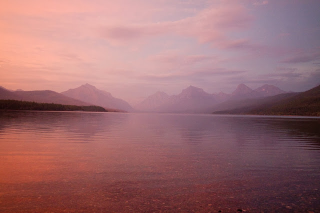
Following dinner, we drove the final hour back to Apgar to our motel room. We decided to take a stroll along the beach of Lake McDonald as the sun was setting before crashing for the night. It was absolutely beautiful!

Click here for photos from Glacier National Park

Tuesday, October 1, 2013

Adventure Honeymoon 2013 - Epic Journey Day 6

Start: Elizabeth Lake (Foot) Campsite
Exit: Ptarmigan Trailhead
Mileage: ~10.6 miles with ~4.2 miles spur trail to Iceberg Lake
Elevation Up: ~2518 feet
Elevation Down: ~2480 feet


It was another morning of tearing down camp, followed by a quick breakfast with our campmates before beginning our last day on the trail.


Right from the start of our hike, we began ascending the mountain via a series of switchbacks weaving up through the trees. As we climbed up and up, Ben paused to capture views from the overlooks on his camera and to scavenge berries. Raspberries and thimbleberries were favorites of the day, choke cherries, elderberries and various other mystery berries were huge disappointments.


After about 1.5 hours, we reached the ridgeline, where the forest faded into open scree fields. We traversed these slippery slopes as they climbed toward Ptarmigan Tunnel. While keeping our eyes open for any grizzlies that might be playing in the fields below us (at a safe distance for photo ops), we spotted a pair of moose grazing and paused to take their pictures and snack on some raspberries near where we sat.


We dusted ourselves off and continued climbing the final ledge to Ptarmigan Tunnel. As we proceeded past the man-made wall that lined the walkway, we paused to admire the nearby glaciers and listened to their creaks and groans.


Despite having climbed over 2000 feet in our first 5 miles, carrying heavy packs, we appeared to be the first people of the day to reach the tunnel. We took some photos on the north-west entrance of the tunnel, chased a chipmunk out of the dark as we admired the stonework and noted the sidewalls a ranger had told us before were designed to keep horses centered within the tunnel so riders in years past would not bump their heads on the ceiling.


As we emerged on the south-east side, we met the first hikers arriving from that side. After a few pictures there, we sat down for 1st lunch and defended Kari's goodies from our pesky chipmunk friend (PLEASE DON'T FEED THE ANIMALS).


Following lunch, we continued down the mountain, past numerous day-hikers, admired their various fragrances, and were amazed at the fear of bears which the park had instilled in them.


Kari became increasingly concerned about whether Kari would be able to find a place to pee with all the day-hikers on the trail. What an inconvenience! Fortunately, Ben stood watch and crisis was averted.


Other than a short pause to photograph a mountain goat family, playing on the snow off trail, our descent went uninterrupted and we quickly arrived at the intersection with Iceberg Trail. Taking the path leading up toward Iceberg Lake, we climbed up what smelled to be a popular day hike trail. With our big backpacks, questionable body odor, and Ben stopping intermittently to snatch thimbleberries off the bushes, we definitely stood out. When we made it to the lake, we sat down for 2nd lunch and filtered some of the icy water to wash it down.


With our tummies and water bottles full, we began our descent, keeping an eye on the grey clouds that were starting to roll over the valley. We passed the sign indicating the direction to Many Glacier and set off in the direction of our final 2.8 miles toward Many Glacier Campground. We held hands when the path was wide enough to do so. Our feet had already begun to hurt - 13 miles in a day seemed to be Kari's limit with a full pack. The backwoods phase of our adventure honeymoon was coming to a bittersweet and drizzly end.

We held hands as we stepped off the trail and into the parking lot. With no clear idea of exactly where Many Glacier Campground was and no desire to walk on the hard asphalt any more than we had to, we strolled together down the street to Swiftcurrent Motor Inn Office. Taking charge, Ben approached the front desk and asked where the campground was and where to be to get on the 9am shuttle the following morning, so we could get to our rental car and retrieve Ben's Honda from Kintla Lake on the opposite side of the park.

Good thing he asked!

Despite having been told over the phone during the planning months preceding our trip several times that the 9am shuttle would be available, the 9am shuttle would, in fact, NOT be running anymore. Fortunately, we arrived 30 minutes prior the 4:45pm shuttle, giving us just enough time to find a room in East Glacier for the night prior to picking up the rental. The manager on duty pointed out the East Glacier accommodations to Ben and handed him the phone, wishing him luck finding a room. After a couple no answers, Ben found us a place to stay for the night, so we went out to wait for the shuttle.

While we sat on the kid-sized bench by the door, we met a small group of thru-hikers who were almost finished traversing the Continental Divide Trail. They carried minimal gear, but claimed to hike ~30 miles/day, making Kari feel like an absolute weenie.

When the shuttle arrived, we hopped in the back to keep our smell (which had only gotten REALLY bad on this final day) away from the other riders. We moved up by the driver when the other riders had left and were joined by one last rider. This man was probably ~30 years old and had been doing seasonal concessionary work and exploring the world since graduating college. Now, he and his girlfriend travel and work together, getting jobs via connections and storing up letters of recommendation. But as they get older and thoughts of kids start to enter their minds, things would be changing and the transition might be difficult. This was a very interesting conversation for Kari because that was how she had wanted to live but she had chosen a different path. Glacier for season, then off to Nepal, then who knew!

The shuttle driver was also a seasonal worker - he and his wife worked at Glacier doing more grown-up jobs over the summers and stayed in provided housing.

The driver kindly dropped us off at the door of the convenience mart/Avis/etc. where we met the store owner who also owned the motel we would be staying at, along with several other businesses in town. We dropped off our bags at The Whistling Swan Motel, bought two pizzas (1 12" pizza for each of us) and demolished the food, while sitting on the "dirty" bed. We splurged with some TV and showers (though the body odor would persist through several washes) and hopped into the clean queen bed for the night.

Click here for photos from Glacier National Park

Adventure Honeymoon 2013 - Epic Journey Day 5

Start: Stoney Indian Lake Campsite
Camp: Elizabeth Lake (Foot) Campsite
Mileage: ~14.4 miles and ~1 mile with spurs to Cosley Lake and Dawn Mist Falls
Elevation Up: ~1200 feet
Elevation Down: ~2708 feet


Kari was all too happy to be leaving Stoney Indian. Goodbye cold mountain shadows! Goodbye memories of heat exhaustion and chemical burn! And goodbye awful pit toilet! After breaking down camp and a tasty kiwi berry smoothie for breakfast, we were on our way before our campmates even left their tent.


We began up the steep climb - a series of switchbacks that lead out of the basin, up and over the side of the mountain. Upon reaching the top, we noticed a distinct change in the frequency of useful trail signs indicating which paths were overlooks/scenic/game trails and which was the true path. Fortunately, we chose the correct paths and were able to navigate the basin and valleys on the other side successfully.


The trail leading down the mountain was beautiful, taking us past high mountain glaciers, through tall pines overlooking lakes, across rivers that lead down to waterfalls, cascading into the valley below.


As we descended into the valley we passed through many berry bushes and Ben got to snack on thimbleberries. We did not encounter any bears amongst the bushes; the mountainside shaded us from the sun; and the sight of rivers, waterfalls and lakes below kept our spirits high.


As we descended into the valley, the trees grew thicker and continued to shade us. It became apparent just how far Mokowanis Lake would have been and we were grateful for the permit change, especially given the circumstances of yesterday. Upon the recommendation of several hikers we'd passed by, we made a mental note to stop by Cosley Lake before fording the river and continued onto Elizabeth Lake.

In the valley, we were warned by several hikers that a black bear sow and her cub had been seen hanging out by the Glenn's Lake (Head) Campsite. And, sure enough, despite our loud conversation, bear bell, and boisterous versions of "Call Me Maybe" and 'guess that song', there they were on the trail. Ben saw them first and stopped Kari. This time they did not run. We did our, now practiced, bear encounter procedure - Ben took the bear spray out of Kari's pack and Kari took Ben's as he moved between her and the bears, both of us careful to leave the safety firmly in place. Mama bear moved slowly toward us and baby bear stood up on tip-toes, trying to see around her. We packed up slowly, talking calmly to the bear. After briefly considering us, Mama bear took her cub and ran off into woods. Grateful that we knew roughly where they were, we moved slowly and noisily down the trail before putting our bear sprays away.

We stopped for 1st lunch in the food prep at Glenn's Lake (Head) Campsite before continuing on. After many bungled renditions of Journey's "Don't Stop Believing", "Call Me Maybe", and various Christmas carols, we arrived Cosley Lake. The mountain and lake views from camp were beautiful and we noted that this would be a good place to stay in the future.


We were tauntingly close to the ford site but, looking back at the trail behind us, the view of the mountains lakes and rivers we had traversed in just this one day was incredible.

Two rangers sauntered up behind us on horses and we shared our bear encounter stories while they examined our permits and then mosied on.

Finally, we reached the river ford site. Now, we had come "Boy Scout Prepared" for just about anything, but fording the river was our one major unknown. We had no idea how deep the water was, how fast, how sharp the rocks would be, etc. But we were pleased to find that the river was mellow and only came up to Kari's upper calves in the deep spots. We crossed, one at a time - 1 hand on the cable that ran above the water, the other clutching one of Kari's trekking poles for extra balance. Ben was very happy to find the river-bottom rocks were worn and smooth against his bare feet (Kari was in flip-flops).

After our successful river crossing, we rewarded ourselves with 2nd lunch, sitting on the riverbank and gazing at the majestic mountain view.


Following lunch, we dried our feet and trekked on through the forest. We discovered "Dawn Mist Falls" - one spur to a waterfall that actually WAS worth the extra effort, a short way off the trail. Then we continued on to finish up the final couple miles to Elizabeth Lake (Foot) Campsite.

We were very happy to reach the food prep area and have a quick snack. Our feet had really hurt during that last mile and Kari was grumpy. When "the gorgeous" is grumpy, nobody is happy.

After putting our food in the bear box, we set out our tent to dry from last night's dew and endured mass assault from horrible little green bugs while we filtered water by the lake (careful to get water FAR from where one of our campmates decided to pee on the beach - you could tell we were getting nearer to the exit point).

We had a good, long evening eating dinner and socializing with our fellow campmates. We met Dustin, who was a wildlife biologist and field workers traveling from job-to-job and backpacking in between for the last several years. The pair we had met as we arrived at Stoney Indian Lake joined us here - they appeared to be siblings who loved to sleep in, eat full-fat southern dishes and carried a portable shower. Matt and Ellen were Montana natives and friends of Dustin just out for a night before going back to college for the Fall. The eclectic group had an interesting dynamic, with one main commonality - a love of time in nature. We stayed up, swapping stories until long after the stars came out.


When we did retire for the night, we laid half-out of our tent, balanced the camera in a hiking boot "tripod" and took some awesome star photos before going to sleep.

Click here for photos from Glacier National Park

Monday, September 30, 2013

Adventure Honeymoon 2013 - Epic Journey Day 4

Start: Goat Haunt Shelters
Camp: Stoney Indian Lake Campsite
Mileage: ~7.5 miles with ~1 mile spur to Kootenai Lake
Elevation Up: ~2125 feet
Elevation Down: ~0 feet


Our morning began, as the other mornings had, with an early wake up (~6:30am courtesy of the built-in Benjamin alarm clock) and tear down of camp. After bidding Terry and Christy an uneventful day and a more successful boat ride to Canada and eating a quick breakfast bar, we were back on the trail. Today was going to be our short day and Kari was a little cranky about not being allowed to sleep in or soak in the beauty of the lake more, but Ben wanted to get to the lake at our next camp early so he could wash his clothes and take a bath/swim in the lake.


The first 5 miles of our hike were flat and went by quickly. We discovered some meadow clearings that Ben was enamored with and hiked under the shade of fully grown trees. Although it was still early, the air was heating up fast and it looked to be a beautiful, sunny day.

On the recommendation of a friendly Swede we met on-trail, hoping surely (in vain) to find cell service to message his mother, we took a .5 mile spur to see Kootenai Lake. As promised, it was well worth the extra walk. The water was serene and glass-like, perfectly reflecting the mountains around it. We made a mental note of the campsite for future visits.


With about 2.5 miles to go, we began going up the rapid ascent in elevation we had known was coming. Kari had enjoyed the hike and elevation changes on Day 2 so much that she was looking forward to crushing this climb too and reaching the beautiful vistas above.

The sun beat down on us and we continued our climb, soon finding ourselves on a mountainside, completely surrounded by berry bushes that crowded the path, trapping the humid heat of the day against our bodies and blocking our view of the rest of the mountainside and what lay around the next corner. Though in the endless series of steep/sharp switchbacks, the answer was pretty easy - another overgrown switchback. In the midst of trudge through the bushes, Kari could not see much of the scenery around and began to look at her feet and the path directly in front of them. While the bushes around her did not seem to change, at least she knew her feet were moving.

"Bear!" Ben yelled after we turned a quick corner and grabbed Kari's pack to stop her. Meanwhile, Kari only heard the crash and saw leaves moving in the bushes ahead.

We were about halfway up the mountain, completely surrounded by berry bushes and we could not see anything but the path on our current switchback. As soon as Ben had yelled "Bear", the small black bear dove into the bushes.

"Should we go backward?" Kari asked as Ben took the bear pepper spray out of Kari's bag and she took the can of bear pepper spray out of his.
"We do not know where it is. We cannot see. It could be behind us by now." he responded.

He had a point.

We each removed the safety from our bear pepper spray. In the process, some discharged onto Ben's hands and face. Imagine rubbing oil from several habaneros all over your hands and face. At first, there is only a slight tingling followed by extremely intense burning. Burning so intense that it feels like your skin is peeling off. Typically, you would flush the oil from your skin for 15-20 minutes with cold water; however, we were on the side of the mountain without water. Despite the burning, we decided to continue forward along the trail slowly and loudly. Kari's adrenaline was pumping. We had perfected the lyrics to "Call Me Maybe" (courtesy of Canadian Alex who had hummed it repeatedly at Hole-in-the-Wall) earlier the previous morning. Ben requested that Kari sing it and clack her trekking poles together as we wound our way through the never-ending bush-encased switchbacks.

Kari worried.
What if the capsaicin from the bear pepper spray got in Ben's eyes?
Would it blind him?

It was already on his forehead and lips, spreading as sweat carried it dripping down the flushed splotches of his skin. We tried wet wipes to no avail. Ben grunted as his face grew redder and told Kari to hurry and that he needed water soon to flush it. Kari hurried on, pushing through berry bushes that scratched her exposed legs and arms and tugged at her pack, clacking her poles and singing that darn song over and over again, as loudly as she could while Ben tried to stifle his pained grunts. Gasping for breath, Kari eventually had to stop a moment in the shade of two solitary pines. Kari was hot, she realized. Kari was terrified that she'd turn the next corner and be nose-to-nose with a bear. She hated that she could not do anything to help Ben or to stop the burning that had begun on her septum. While we stopped, Ben had Kari spit water from her bladder onto his face to stop the burning. Kari was terrified that she would get it in his eyes and blind him. Kari realized, with the water in her mouth, that she had not drunk any water since encountering the bear. Ben could not take the pain any longer. After about 30-45 minutes of burning, we finally found a creek - he laid down on the rocks and stuck his face in the rushing water over and over again. The cold water on his skin, cooling it and flushing the chemicals off provided the relief he needed. We sat there for a brief lunch so Ben could stick his face in the water intermittently.

After a lot of flushing, Ben seemed to be feeling better. His arm now burned too, but his face felt a lot better. We had finally made our way out of the giant mountainside of berry bushes, but wound up on another exposed mountainside, surrounded by overgrown foliage and, later, more #@$!#$& berry bushes. As we continued up the steep switchbacks, Kari's body began to fail her and her skin grew cold. Of course, this only made her more frustrated and her will power plummeted. Kari was mentally, emotionally, and physically exhausted. Ben got behind me and cheered me on, then led the way through the brush as she trudge up the mountain.

By the time Kari stumbled into camp (around 1:45pm), it was apparent that Kari had been suffering from heat exhaustion. We went to food prep, sat in the shade, and made sure we drank water and ate a little food to recover. That may have been the shortest hike, but it sure kicked our butts!

After some recovery, we put our smellies in the bear box (way more convenient than hanging) and split up to do the camp chores. Kari assembled the tent and set up camp while Ben filtered water. But first, Ben set about doing his laundry - soon he was in his boxers, sitting on a rock, rubbing his clothes in the sand and letting them dry in the grass. The pair who had left camp soon after we got there was gone and no one was there to see until a couple came passing through. When we were alone, Kari joined Ben in washing her clothes and even got in the freezing cold water with him and dunked up to her shoulders. Ben swam around a bit to "bath" himself.


While the clothes dried, we did our respective chores. Kari squatted down, still wearing her Frogg Toggs to keep warm while she was wet, and busted open the seam along the whole crotch of the pants. Note to self: avoid doing camp set-up tasks and squatting in Frogg Toggs. Thank goodness for duct tape. We also discovered the pit toilet, which was no more than a mostly-full hole w/ a box seat placed on top of it - no walls whatsoever. It had a great view, as Ben pointed out. He thought it was hilarious but Kari was freaked and, thinking that ANYTHING could crawl or fly in and then come out when she sat down. Kari was also not a fan that the only privacy source was the toilet's distance from camp. Kari made Ben go with her whenever she needed to "use the facility" there. Kari would later be vindicated when another woman admitted similar fears with the toilet and, with no hubby to accompany her, she ran the whole way back, terrified.


After setting up the tent in the freezing shade of the mountain (our site was in a basin), Kari joined Ben by the clothes over on the sunny side of the camp.

Still trying to alleviate the burning on his arm, Ben tried applying neosporin, thinking it might numb the skin. Kari used some on her nose, but found that instead of numbing her skin, it caused the burning sensation to intensify. She ran to the lake and flushed her nose and lips with lake water for 15-20 minutes. Ben, being the wonderful man he is, put the smellies back in the bear box and sat by her side, scratching her back as she flushed her face. We rinsed off the outside of the bear spray can as a precaution to avoid further incidents. The oils from the can formed a swirly pattern that coated the surface in the corner of the lake.


Crisis averted, we sat by our clothes drying in the sun and journaled until it was time for dinner. It was an experimental, trial 1 recipe: Chili Mac (bland with a weird texture from the blended up beef). It was hard to get through. Only the promise of a tasty dessert spurned Ben on. After teeth brushing and a quick meet-and-greet with the late-arriving man and woman in camp, we were off to bed for an early night. Also, Ben used up the last of the TP. He thought it was funny. Not "haha" funny, but "uhoh" funny. Kari was not amused.

Click here for photos from Glacier National Park